This 10 mile hike in southwest Virginia’s Grayson Highlands State Park was beautiful and marked the completion of my second state high point (my first being Washington, DC).
You begin this hike at around 4,500 ft in elevation, and it gradually climbs to 5,700 feet – the highest point in the commonwealth of Virginia.
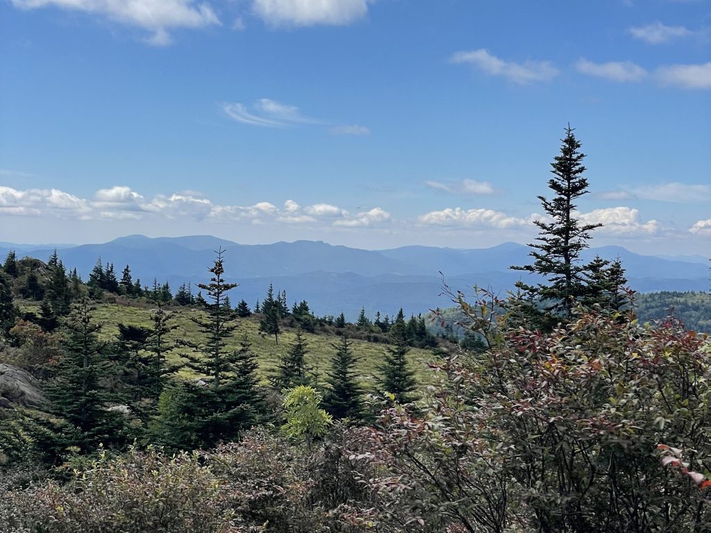
These trees, holdovers from the last ice age, manage to survive today due to their high elevation. Mt. Rogers’ gorgeous landscape, unlike anywhere else in Virginia, captured my attention throughout the hike, for how much it reminded me of West coast forest lands I grew up around.
From the trees, to the mosses and fungi, to the sprawling ridge lines, I took a lot of extra time on my way up snapping photos. This made for a long, but awe-inspiring day.
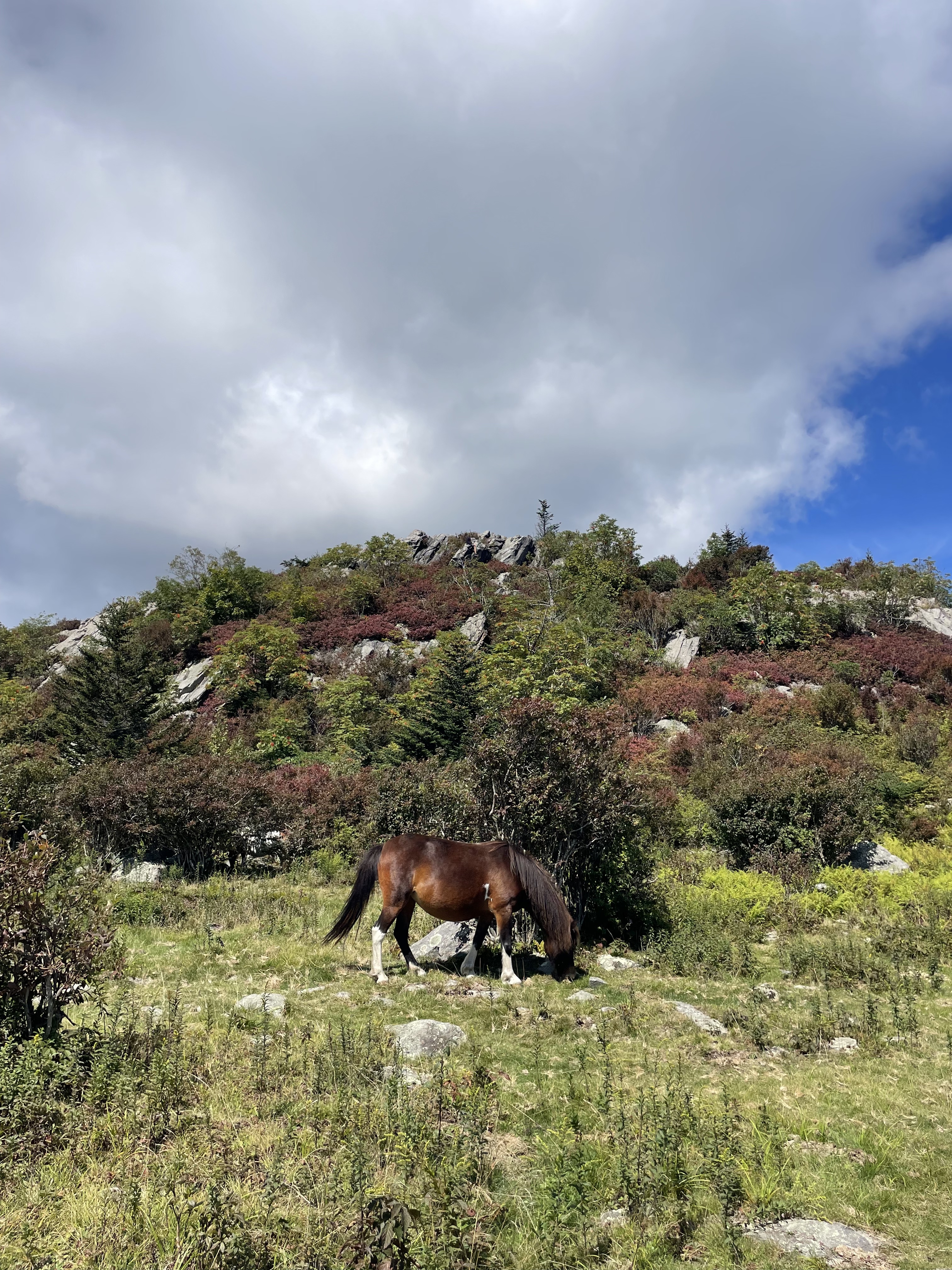
I completed the hike in about 6 hours, and did manage to see a few “wild” ponies along the way. Grayson Highlands is known for them, although they’re not really wild, and were introduced by humans into the landscape to manage vegetation. They are still managed to this day, but are free to roam around the park.

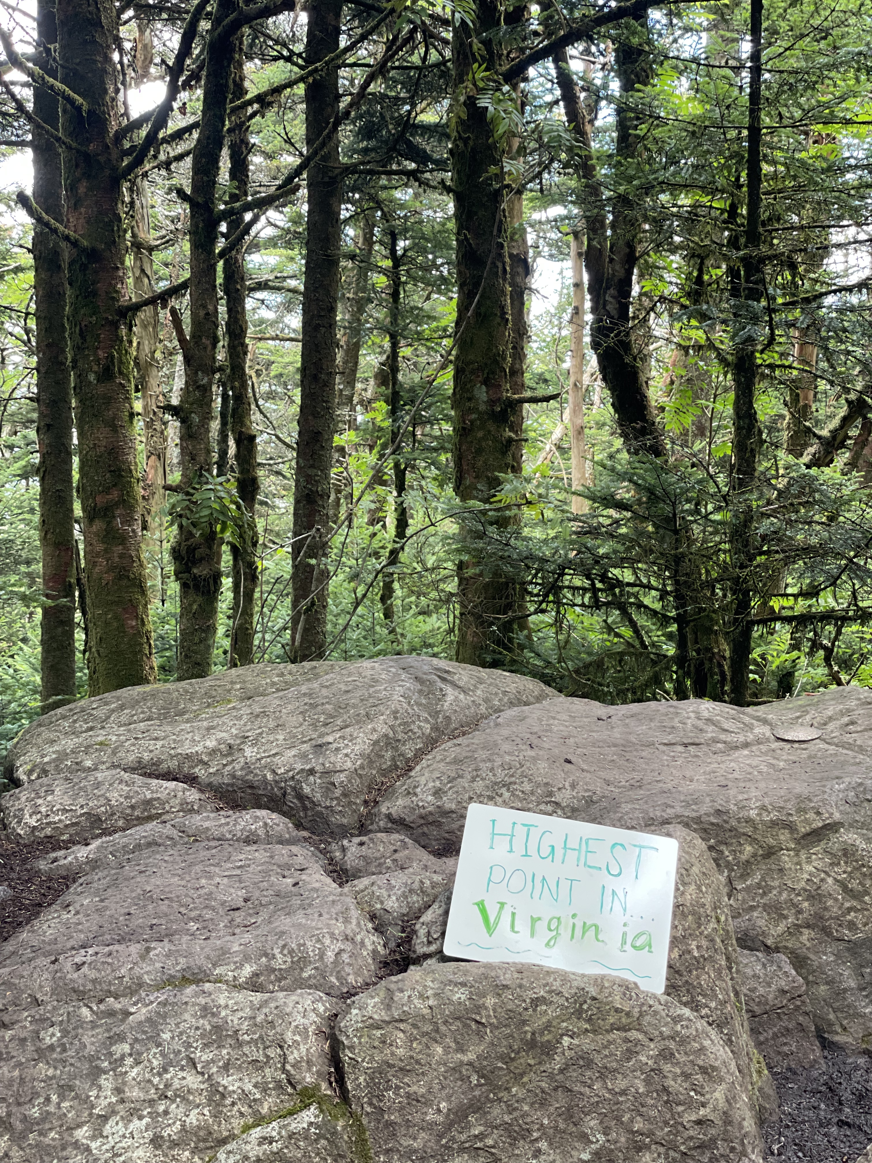
At the summit, the peak and geological marker for the state high point are enshrouded in a dense spruce and fir forest, covered in glowing moss. On AllTrails, people complain that this means there is no view at the peak. I find this a bit silly because 1) these evergreen forests are a view in and of themselves, in my opinion, and 2) you get tons of beautiful far-off mountain views throughout the hike.

I fell in love with this trail, and will definitely be back. Have you visited? What did you think?

Leave a comment